Thursday, April 28, 2011

Spring: A Trip Down The Road

On last weekend, I had the fortunate opportunity to enjoy a pretty spring day with my nephew.  We left from Franklin and went down Highway 383 to 664.  We stopped at J & J Country Market to get a couple of sandwiches and chips to eat along out journey.  Our destination?  Adairville, KY, which is about 20 miles from Franklin.  I have traveled this route many of times, but never with a camera taking pictures.

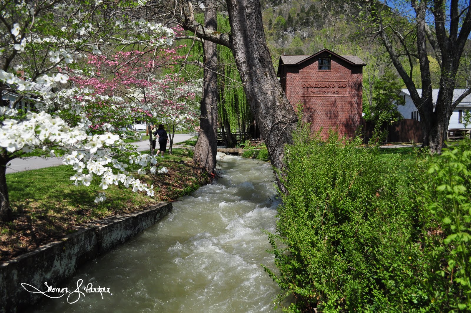
Our journey began with going to the Red River Meeting House, site of the famous Great Revival of 1800.  At the time the settlement, located near the Red River in Logan County, was considered the Western frontier.  The revival "was the preserver of Christianity on the frontier when greed and wealth threatened to supplant God and country in man's lives and when the spread of population westward threatened to make us an unchristian nation."  Although the original structure is long gone, what remains there today is a cemetery and a church recreated to look similar to the original structure.  When traveling on Highway 664, which turns into Highway 663 after passing the tiny community of Schochoh, you will see the sign for the Red River Meeting House about a mile up the road on your right (coming from Franklin).  You take a little gravel road about 200 feet to the cemetery.  There, you will find a pamphlet that provides you with a self-guided tour of the cemetery and history of the Red River Settlement / Meeting House.  In the cemetery, you will find a Revolutionary War soldier, Civil War Soldier(s), doctors, and even Psalms 23 written in Gaelic.  Just think....all of this just barely 10 miles down the road past Sulphur Springs Baptist Church.  The first picture is of the Red River Meeting House sign. 


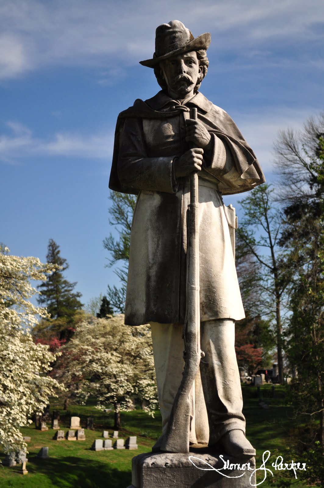
The second and third picture is of the same.  The third picture is the picture of the plaque that is on the grave.  This person (Robert Paisley) served as a captain during the Revolutionary War.  He passed away at 89 years old in 1828, which means that he was born before America was a nation and even lived during the time of the French and Indian War.  I find this interesting because you do not see many of these markers this side of Appalachia.


After leaving the Red River Meeting House, we continued onto Adairville, KY by taking Highway 663 to Highway 431 south.  Adairville is a small town in Logan County located near the KY - Tenn state line.  Although a town with a stoplight, I would recommend stopping and embracing the history of the town, especially during the annual Strawberry Festival.  Adairville was famous for its ties to Jesse James and his Gang as well as a duel with Andrew Jackson.  The fourth picture is looking onto Prices Mill Road from downtown Adairville.  For me, this picture embraces the essence Christianity and agriculture, which this community was built upon.


I added this picture of this bar because of its location upon the Kentucky and Tennessee state line.  The building is divided between Kentucky and Tennessee (as seen on the front of the bar with the K and T).  They even have the state line drawn on the inside of the bar as well.  I thought that this picture was interesting.


After leaving Adairville and "pop-locking" in the car, we met up with some friends at Sulphur Springs Baptist Church to take pictures.  Of the pictures that I took, I really like this one taken from the baptistery looking onto the sanctuary.


Last, but not least.... " A Field of Gold".  This picture is of a field of Canola.  From a distance, it looked like a sea of Gold.  I do want to give a special thanks to my nephew for putting up with my stop and go approach while on our journey and the Byrums for taking time out to meet up with us to take pictures.  Thank you all.  :)


Monday, April 25, 2011

A Moment In Time

In the beginning of April, I drove through Woodburn, KY on my way to Bowling Green to meet my mom for lunch.  While in Woodburn, I wanted to stop and take a picture of an old church steeple that was standing erect...the church building itself long gone.  However, when I passed, the steeple had fallen.  Tonight's pictures and short blog is about capturing those special moments of time...those moments that if not caught will fade away into oblivion.  How often is it that we are told of a place that was torn down or closed and we think of the many memories associated with that place.  It could be a favorite restaurant, an old church, an old school building, family home, place where you went for boy scouts, or a place where you had your first slow dance with a girl.  At any rate, the tearing down of these places can unofficially closes a chapter(s) of our life.

The first picture is of a tree that I have captured in a previous post.  So, why add it on here?  The tree has been dead for a while, but has not fell or been cut down.  However, with the recent storms, a huge limb fell to the ground.  Probably the next time that I am home, this tree will no longer because it will be cut / sawed down.  On Saturday night, I set up my tripod and captured the tree as storm clouds were entering in from the west.  What I did not think about was the effect of the clouds coming in and the scarce light hitting the tree during a 2:30 minute exposure.  When I look at this picture, I feel that the tree is glowing...sort of on fire (like the burning bush with Moses).  The clouds add a glowing effect from the tree.  The light in the sky is a star and the red light is a TV antenna in the background.


The second picture is of the steeple that I mentioned in Woodburn, KY.  I took this picture using my Kodak EasyShare back in 2009.  Even at the time, I thought to myself that a good wind would knock this steeple down.  I am glad that I captured this picture when I did because as my mom says all of the time..."don't put off to tomorrow what you can do today."


The final picture of the one and only...Franklin-Simpson High School Gymnasium (taken February 2011 with the Nikon D5000).  This year marks the last time this gym will be used for organized basketball games.  It served host to many of awesome teams, phenomenal games, rough practices, heavy ropes, running the stairs, and Coach Bell-isms (Newwwwtoooooooown).  For me personally, these things helped pave the way for my future (or could have been those heavy ropes beating me)...who knows...

Thursday, April 21, 2011

Sunday Drive: Cumberland Gap

One thing that I like to do (for any of those that have been on journeys with me) is to find a place and GO, especially on a pretty day.  The pictures tonight were taken this past weekend at the Cumberland Gap.  For me, I enjoy going to the Cumberland Gap because of the scenery, but also the accessibility.  It is only about an hour from London, which makes for a beautiful drive as the terrain chains from hills to mountains.  The Cumberland Gap was a pass along Cumberland Mountain portion of the Appalachian Mountains.  Historically, people used this pass to cross from Tennessee and Virginia into "Kaintuck".  Dr. Thomas Walker and his crew of surveyors crossed into Kentucky via the Cumberland Gap (c. 1750).  Daniel Boone widened the original path to make it more accessible to pioneers.

Although now a tunnel takes you straight through the mountains, it is still nice to go to the Gap and be a "tourist" for the day.  Coming from I-75, you will go past Corbin, Barbourville, and Middlesboro.  From there, you have the choice of going up to the Pinnacle (which is slightly more than 2000ft above sea level) or continue on 25E through the tunnel.  After going through the tunnel, you are at an intersection to where you can continue straight into TN or go left into Virginia.  Now, I will say that if you continue on either of these routs then you will miss a hidden jewel in Cumberland Gap, TN  (home to Lincoln Memorial University).  Cumberland Gap, TN, preserved by the rerouting of the primary road outside of the town, gives you in essence a tourist view of small town Appalachia.  If you go, park your vehicle...walk around...and be a tourist.  Have dinner in a local diner and walk around town.  Go see the Iron Furnace or the bicycle museum.  Below are just a few pictures from the town.  The pictures does not do this place justice and it is worth a trip.

The last picture is one of the views from the Pinnacle.  After leaving Cumberland Gap, go back out to the main road and hit 25E going West.  Get off at the first exit to go to the Pinnacle.  After going up a few windy turns, you will come to the parking area.  From there, it is only about 200ft to the Pinnacle.  It is here that you can stand in one place and see three different states.


Monday, April 18, 2011

Frankfort Cemetery

The pictures that I am sharing tonight were taken last week at the Frankfort Cemetery.  I know, I know, it is pretty creepy taking pictures in a cemetery, and trust me...I normally don't like to take pictures in a cemetery.  However, this cemetery possesses not only history, but also is simply beautiful.  If it was not for a dear friend that took me up there on a very nice fall day back in 2009, I would have never been enamored so much by this site to take the opportunity to go back and take pictures again.  The cemetery overlooks downtown Frankfort and the State Capitol.  Although I have not seen all of the sights of Frankfort, I will say that it one of the most gorgeous sites in Frankfort.  This cemetery is famous for interring the remains of Daniel and Rebecca Boone (although questionable) along with other notable residents of Kentucky.  The cemetery became in use on February 27, 1844. 

The first picture is of Daniel Boone's Grave.  According to Wikipedia (not a credible source, but a good start to find information): "In 1845, the Boones' remains were supposedly disinterred and reburied in a new cemetery in Frankfort, Kentucky. Resentment in Missouri about the disinterment grew over the years, and a legend arose that Boone's remains never left Missouri. According to this story, Boone's tombstone in Missouri had been inadvertently placed over the wrong grave, but no one had ever corrected the error. Boone's relatives in Missouri, displeased with the Kentuckians who came to exhume Boone, kept quiet about the mistake, and they allowed the Kentuckians to dig up the wrong remains. There is no contemporary evidence that this actually happened, but in 1983, a forensic anthropologist examined a crude plaster cast of Boone's skull made before the Kentucky reburial and announced that it might be the skull of an African American. Negro slaves had also been buried at Tuque Creek, so it is possible that the wrong remains were mistakenly removed from the crowded graveyard. Both the Frankfort Cemetery in Kentucky and the Old Bryan Farm graveyard in Missouri claim to have Boone's remains."  Interesting stuff, right?


The second picture is of a Confederate Soldier.  This momument is for the members of the Confederate Army that died during the war.  At the base of this monument, there is a circle of headstones surrounding the statue..


I took the third picture because it is the first time that I saw a Kentucky Historical Marker in Red.  Does anyone know why this marker is in red?  I will say that it is an interesting historical fact though...


The fourth picture is of a military monument commemerating the fallen soldiers in US wars prior to 1850 (i.e. Tippiecanoe and Blue Licks).  The memorial was built c. 1850.


The last picture is of the view from the Cemetery looking over downtown Frankfort, KY.  To the left, but out of the picture is the State Capitol.


I normally recommend for people to visit places that I have been because I know I have been amazed at all the beauty that is here in Kentucky or surrounding areas.  Most of these places are within an hour or two driving distance from where I live (or have lived).  With the cemetery, I will leave it to your discretion, but trust me...you will not be disappointed if you take a chance, like I did, to venture around the cemetery on a beautiful day.

Tuesday, April 12, 2011

Harlan County: Pine Mountain Settlement School

Tonight's pictures were taken at the Pine Mountain Settlement School in Harlan County, Kentucky (Bledsoe, Kentucky).  I wanted to highlight the Settlement School because I found the grounds to be beautiful and quite peaceful.  Before the days of Public School systems in Appalachia, settlement schools provided the only means of education for children in their respective areas.  Children would stay on the campuses (if local commuting was not accessible) and remain on campus.  Until the 1950's, the Pine Mountain Settlement School was the only school in the area.  For those that have not been to Harlan County, Harlan County is in Eastern Kentucky.  There is not a straight road to access it from the interstate and the area is very mountainous.  Random fact...Black Mountain, which is the highest point in Kentucky, is located in Harlan County (over 4,000 feet above sea level).  Even for us getting to Settlement School was an endeavor.  As we were going up Highway 421, my passenger car window fell out of the tract and almost fell out completely on me.  Let just say, it was a wonderful experience trying to keep it from not falling out completely while going up the mountain.  Back to the settlement school, the school focuses on environmental education.  While we was there, we got to speak with the President of Berea College who serves on the Board of Trustees of the School.  They had finished a meeting and were leaving.  He gave us history, interesting information about the school, and information about the landscape of the campus.  He said that the school focuses on environmental education because there are many rare species that live in the area.  According to him (and I am not sure if I agree with this view or that I will be able to quote exactly what he said), but the Pine Mountain Area is one of the oldest parts of the Eastern United States.  He said after Africa slammed into the Eastern Coast that it killed everything up to the Pine Mountain Area.  Therefore the things that are in the area are unique to that area (yeah, I may have butchered that one).

Well, anyways, below are the pictures that I took while on the campus.  There are more, but I wanted to share these pictures.  The first picture is of the entrance sign from the highway.  The second and third picture is of the chapel on campus.  The chapel was one of the most peaceful places that I have been in a long time.  Truly a gem hidden in a nestled in Appalachia.  My pictures really does not do the chapel any justice.  If you are ever in the area, I highly recommend that you take a second to walk inside of the chapel.  The fourth picture was taken using a silhouette setting in taking a picture of a bell at the chapel looking onto the campus.  We saw a similar picture taken in the 80's and the open field had cows in it.  The last picture is of the women's restroom.  I like this picture with the lighting in background and the placement of the chairs.

I probably have not done justice with presenting information about this school, but you can access more information about the school via the Pine Mountain Settlement School website (http://www.pinemountainsettlementschool.com/). 


Monday, April 4, 2011

Testing 30 second exposures

In life, I am a fervent believer that people come into your life for a moment, a season, or a lifetime.  With any one of these, there is a reason.  A few weeks ago, I looked at a YouTube video talking about long exposures when trying to get more light into pictures.  The man on the video had the camera on Manual setting with a Bulb Shutter Speed and 3.5 aperture.  Well, I had no clue what that all meant....to be honest.  It was not until yesterday while taking pictures at Cumberland Falls Park that the video from a few weeks ago began making sense.  I met someone who is truly a photographer continuing to master her skill.  She and her friend was on a "photo safari" that day.  She was very kind in talking with me about the camera, lens, as well as shooting modes.  She said that she likes shooting in the A setting...to be able to control the amount of light coming into her pictures.  Then, she pulled out her business card and I saw one of the best pictures taken at night time that I have ever seen.  It was of the Moonbow over the Cumberland Falls.  It was then, that I had that "Aha" moment.

With this said...tonight's pictures were taken last night across from my apartment complex in London, KY.  I used a ten second timer with the camera on the tripod to minimize the shakiness of the picture.  The first two pictures and the last were taken with a 30 second shutter speed and 3.5 aperture.  The third picture was taken with an 8 second shutter speed.  I will say that taking these pictures in the dark was simple trial and error (i.e. out of 42 pictures only about 7 or 8 were somewhat good).  These pictures below are not the best pictures in the world, but I wanted to share my "Aha" moment that I had.  I was excited when we started taking the pictures and seeing the outcome.  The anticipation of seeing the picture made the 40 seconds (timer plus shutter speed) go by very quickly.  The first picture is of Big Bob's Burgers with the constellation Orion along the horizon.  The fourth picture is of the Little Dipper.  I did not use a telephoto lens, but kept the camera at 18 - 24mm.  Well, let me know what you all think about these pictures.  Let me know if you all have any suggestions.